Northland Peninsula
Peninsula in northern North Island, New Zealand, with significant geological and historical features.

Earth Science and Remote Sensing Unit , Lyndon B. Johnson Space Center · Public domain
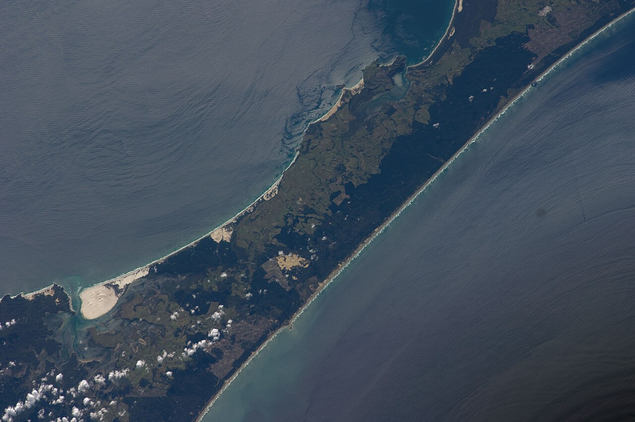
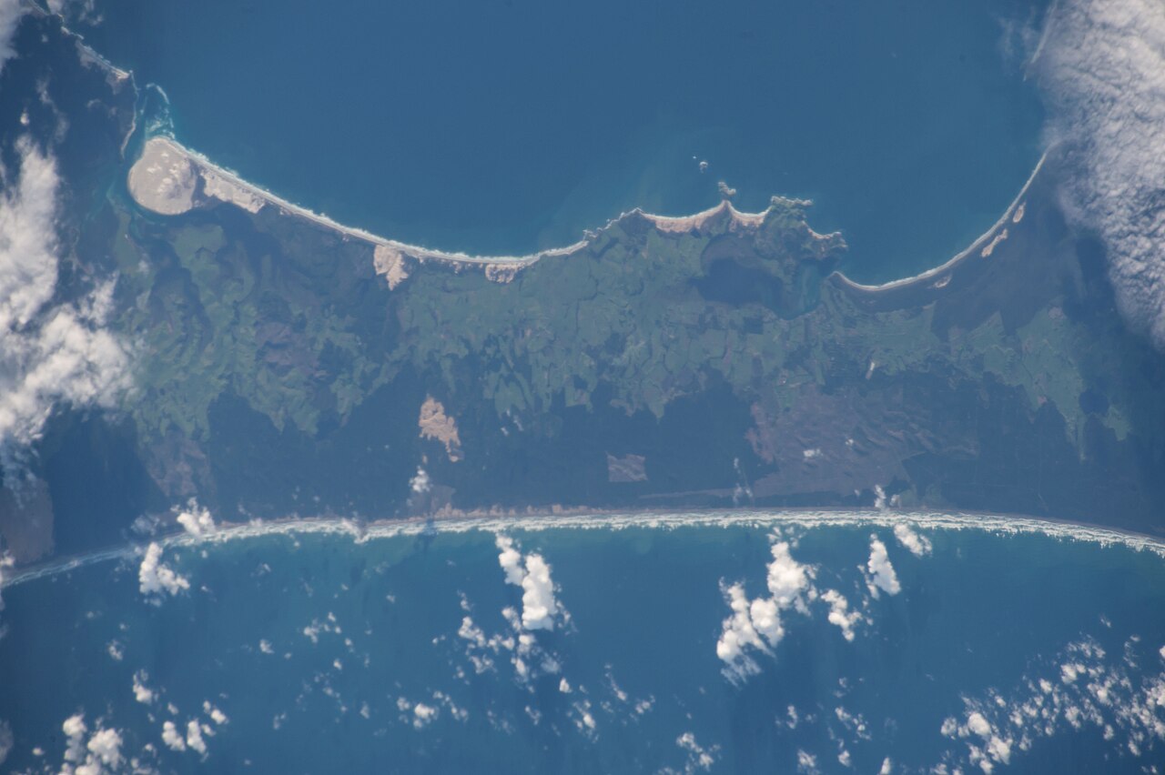
The Northland Peninsula, also known as the North Auckland Peninsula, is a landform in the northern part of the North Island of New Zealand. It is joined to the rest of the island by the Auckland isthmus, a narrow piece of land between the Waitematā Harbour and the Manukau Harbour in the middle of the Auckland metropolitan area. The peninsula is not conterminous with the local government area of Northland Region, which occupies the northern 80% of the peninsula, as the southern section is administratively part of the Auckland Region.
- length
- approximately 330 kilometres
- maximum_width
- 85 kilometres
- formed
- 22 million years ago
- geological_origin
- uplifted by interaction between the Pacific Plate and Australian Plate
- northernmost_point
- Hikurua / de Surville Cliffs at latitude 34° 23' 47" South
- major_harbor
- Kaipara Harbour, one of the largest harbours in the world
Lore & Background
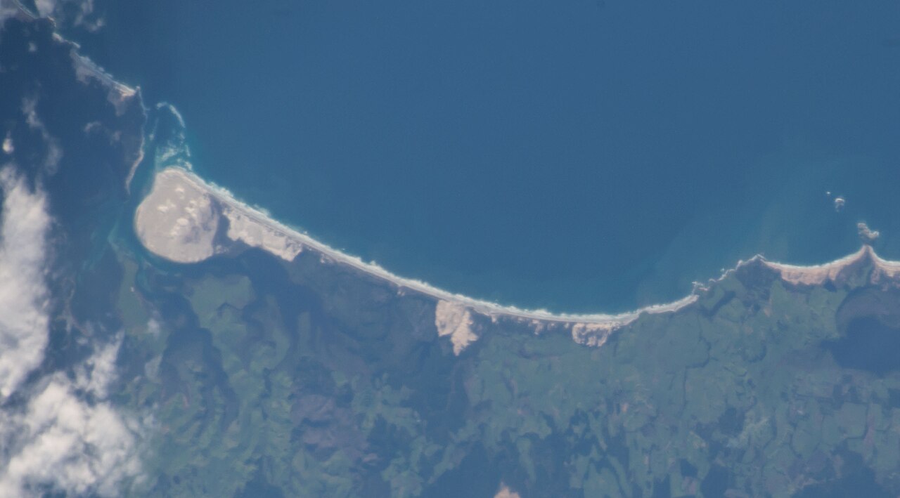
The Northland Peninsula formed as an island 22 million years ago, when it was uplifted by interaction between the Pacific Plate and Australian Plate. Between 25 and 22 million years ago, Northland and the East Cape were adjacent, with the East Cape moving south-east due to tectonic forces. Much of Northland is an allochthon, a large block of land formed elsewhere and moved to its current position. When Northland was uplifted, the sea floor over the central Auckland Region was pushed down to depths of 2,000 to 3,000 metres. The Waitemata Group sedimentary rock found in the Northland and Auckland regions is material that was eroded from the Northland island and deposited on the deep sea floor. The peninsula stretches northwest for about 330 kilometres from the Auckland isthmus, reaching a maximum width of 85 kilometres. It has a convoluted coastline, with many smaller peninsulas branching off it. The northernmost 100 kilometres of the Northland Peninsula forms the Aupōuri Peninsula – a peninsula on a peninsula – narrowing to only some 10 kilometres in width. At its northern end, the Aupōuri Peninsula includes a number of capes: Cape Maria van Diemen, Cape Reinga / Te Rerenga Wairua, North Cape / Otou, and the Hikurua / de Surville Cliffs, the northernmost point, at latitude 34° 23' 47" South. The Kaipara Harbour, part way along the peninsula's western (Tasman Sea) shore, is one of the largest harbours in the world, stretching some 65 kilometres from north to south. Further north is the smaller Hokianga harbour, which has historic and cultural significance, especially to the Māori people. On the eastern coast, another historically significant site is Waitangi and the surrounding Bay of Islands. This was a major settlement area in early colonial New Zealand, and was the site of the first signing (February 1840) of the Treaty of Waitangi, which is seen in the national mythos as the founding document of New Zealand's nationhood. The largest settlement on the peninsula (other than parts of the Auckland conurbation) is Whangārei, on a harbour opening on the Pacific Ocean close to the peninsula's widest point.
Reader's Guide
The Northland Peninsula is significant for its geological history as an allochthon formed by tectonic plate interactions, and for its role in New Zealand's colonial history. The peninsula's formation 22 million years ago and its subsequent movement provide insight into the region's complex geology. The Waitemata Group sedimentary rock found in the area is a direct result of erosion from the original Northland island. Historically, the peninsula contains the Bay of Islands, where the Treaty of Waitangi was first signed in February 1840, a document seen in the national mythos as the founding document of New Zealand's nationhood. The Hokianga harbour also holds cultural significance for the Māori people. The peninsula's geography includes the Kaipara Harbour, one of the largest harbours in the world, and the Aupōuri Peninsula at its northern tip, which features the northernmost point of New Zealand. The largest settlement on the peninsula outside the Auckland conurbation is Whangārei, located on a harbour opening on the Pacific Ocean near the peninsula's widest point.
Did You Know?
- The Northland Peninsula formed as an island 22 million years ago, when it was uplifted by interaction between the Pacific Plate and Australian Plate.
- Between 25 and 22 million years ago, Northland and the East Cape were adjacent, with the East Cape moving south-east due to tectonic forces.
- When Northland was uplifted, the sea floor over the central Auckland Region was pushed down to depths of 2,000 to 3,000 metres.
- The Kaipara Harbour stretches some 65 kilometres from north to south, making it one of the largest harbours in the world.
- The Treaty of Waitangi was first signed in February 1840 at Waitangi in the Bay of Islands.
Tectonic Origins and Geological Identity
The Northland Peninsula owes its very existence to a dramatic collision between two of Earth's great tectonic plates. Roughly twenty-two million years ago, the interaction between the Pacific Plate and the Australian Plate drove the landmass upward from beneath the ocean, transforming what had been submerged terrain into a distinct island separate from the rest of the North Island. Between twenty-five and twenty-two million years ago, this emerging land sat adjacent to the East Cape, before tectonic forces carried the East Cape southeastward, leaving Northland in its present position. Geologists classify much of the peninsula as an allochthon — a vast block of crust that originated in a different location and was subsequently transported to where it stands today. The uplift was not without consequence for the surrounding region: as Northland rose, the seabed over what is now central Auckland was depressed to depths of two to three thousand metres. Over time, material eroded from the Northland island settled onto that deep ocean floor, eventually becoming the Waitemata Group sedimentary rock now exposed across both the Northland and Auckland regions.
Coastal Complexity and Physical Extent
Stretching roughly three hundred and thirty kilometres in a northwesterly direction from the narrow Auckland isthmus, the Northland Peninsula reaches a maximum width of about eighty-five kilometres before tapering dramatically. Its coastline is far from smooth; instead, it is deeply convoluted, studded with numerous smaller peninsulas that branch outward from the main body. The northernmost hundred kilometres of the landmass constitutes the Aupōuri Peninsula — a striking peninsula-within-a-peninsula configuration that narrows to a mere ten kilometres at its tightest point. At the very tip, a cluster of prominent capes marks the extreme edge of the North Island: Cape Maria van Diemen, Cape Reinga (Te Rerenga Wairua), North Cape (Otou), and the Hikurua or de Surville Cliffs, the latter representing the northernmost point at latitude 34° 23' 47" South. Along the western Tasman Sea shore, the vast Kaipara Harbour extends some sixty-five kilometres from north to south, ranking among the largest harbours on the planet. Further north lies the smaller Hokianga harbour, while the eastern coast hosts the Bay of Islands and the settlement of Waitangi. Whangārei, situated on a Pacific-facing harbour near the peninsula's widest point, stands as the largest town on the landmass outside the Auckland urban area.
Founding History and Cultural Heritage
The eastern shore of the Northland Peninsula carries a weight of historical significance that extends far beyond its natural beauty. The Bay of Islands and the settlement of Waitangi were among the most important centres of early colonial activity in New Zealand, drawing settlers and officials to the region in the decades before formal colonisation. It was here, in February 1840, that the Treaty of Waitangi received its first signing — an event that, within the national mythos of New Zealand, is regarded as the foundational document establishing the country's nationhood. The treaty's signing at this particular location on the peninsula cemented the area's place in the collective memory of the nation. Equally important, though less prominent in the broader colonial narrative, is the Hokianga harbour on the western coast. This smaller inlet holds deep historic and cultural significance, particularly for the Māori people, whose ancestral connections to the land and waters of the peninsula stretch back centuries before European arrival. Together, these sites — Waitangi on the Pacific-facing east and Hokianga on the Tasman-facing west — bookend the peninsula's dual heritage, reflecting both the Māori and colonial layers of history that define the region's identity.
Administrative Identity and the Isthmus Connection
Despite its common name, the Northland Peninsula does not align neatly with the political boundaries of the Northland Region. The peninsula, also referred to as the North Auckland Peninsula, occupies the northern portion of New Zealand's North Island, yet its southern section falls under the administrative jurisdiction of the Auckland Region. The Northland Region governs only the northern eighty percent of the landmass, meaning that a meaningful stretch of the peninsula's southern reaches is administered as part of Auckland rather than as part of the region that shares its name. The physical link between the peninsula and the rest of the North Island is the Auckland isthmus — a narrow strip of land wedged between the Waitematā Harbour to the north and the Manukau Harbour to the south. This isthmus sits squarely within the Auckland metropolitan area, serving as the sole terrestrial connection that ties the vast northern landmass to the island's central and southern regions. The result is a geographic entity whose identity is split across two distinct local government areas, a boundary that reflects historical administrative decisions rather than any natural division in the landscape.
Gallery
Frequently Asked Questions
What is the Northland Peninsula?
It is a landform occupying the upper portion of New Zealand's North Island, linked to the mainland by the narrow Auckland isthmus that runs between Waitematā and Manukau Harbours.
How large is the Northland Peninsula?
It stretches roughly 330 kilometers from tip to base and reaches up to 85 kilometers at its widest point, making it a substantial geographic feature of the island.
How was the Northland Peninsula formed?
Roughly 22 million years ago, the tectonic interaction between the Pacific Plate and the Australian Plate drove the land upward, shaping the peninsula into its present form.
What marks the northernmost point of the Northland Peninsula?
The very tip is Hikurua, commonly called the de Surville Cliffs, positioned at about 34° 23' 47" South latitude.
Why is Kaipara Harbour significant?
Situated along the peninsula's coast, Kaipara Harbour is counted among the largest natural harbors in the world, giving the area a distinctive maritime character.
More in Peninsulas And Capes 1-24
Elsewhere in the Peninsulas And Capes universe
Spotted an error? Know more?
This is a living reference — every entry is fact-audited, and reader corrections feed straight into our audit queue. Suggest an edit · See this site's audit record