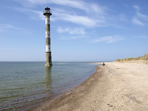
Absheron Peninsula
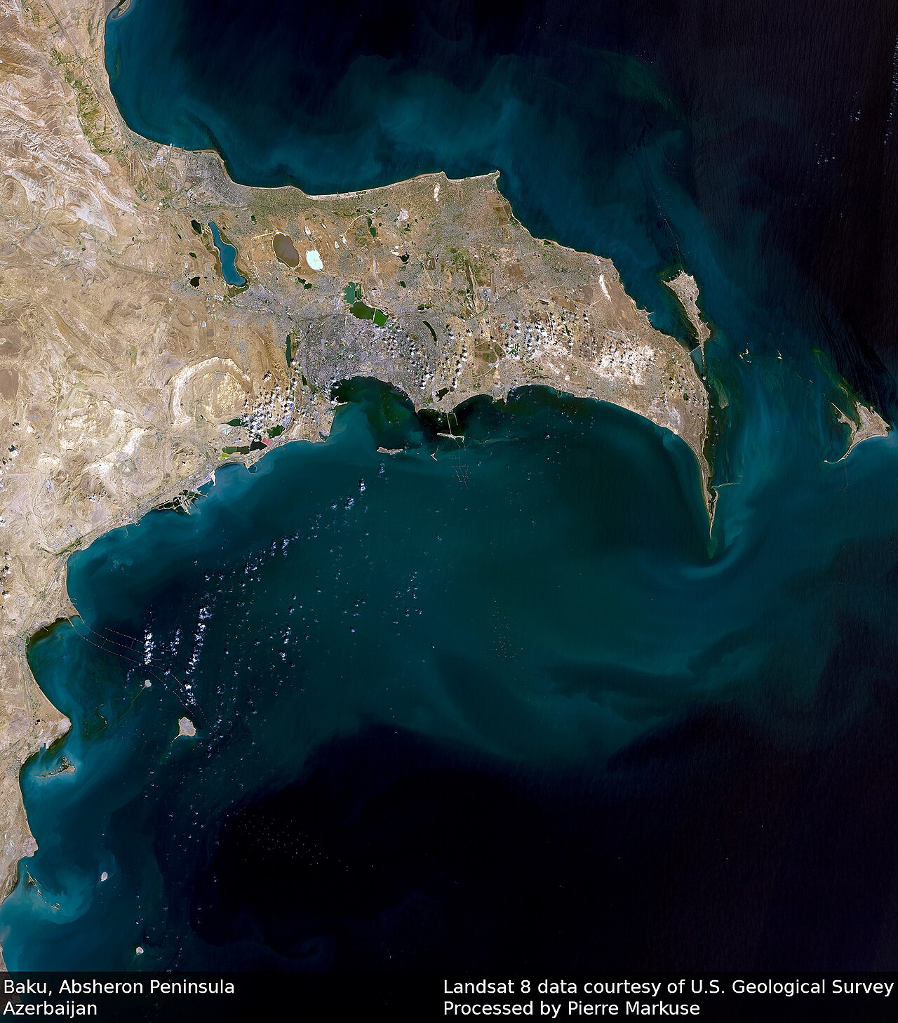
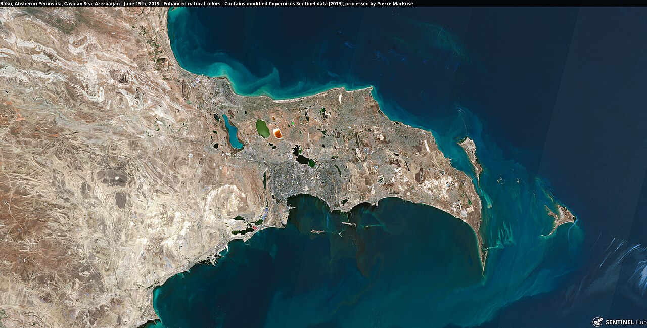
Peninsula in Azerbaijan, site of Baku and early oil production.

Pierre Markuse from Hamm, Germany · CC BY 2.0
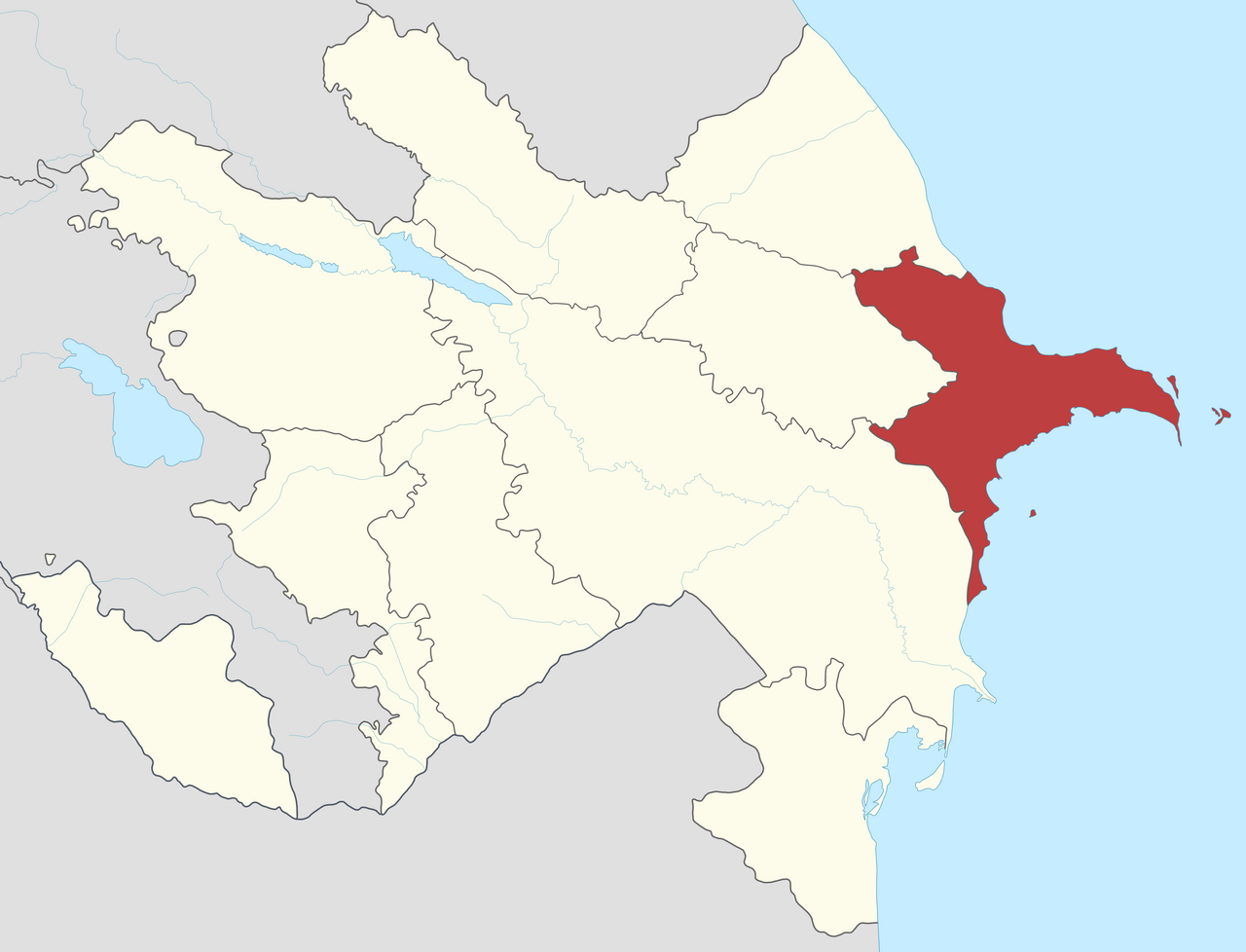
The Absheron Peninsula is a peninsula in Azerbaijan.
- location
- Eastern Azerbaijan, western coast of the Caspian Sea
- length
- 60 km (37 mi) eastward
- maximum_width
- 30 km (19 mi)
- climate
- Temperate semi-arid (Köppen BSk)
- easternmost_point
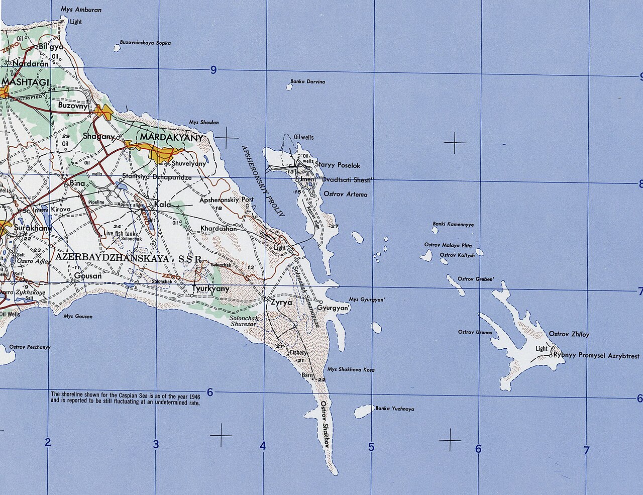
- Shah Dili (Shah Spit), now Absheron National Park
- notable_for
- Site of some of the world's earliest petroleum production, beginning in the 1870
Lore & Background
It is dissected by ravines and has frequent salt lakes. Etymologically, the name 'Absheron' comes from Persian 'āb šurān', meaning 'salty waters'. During the late 19th century, exploitation of petroleum resources caused large-scale migrations of Iranian laborers to the Caucasus, especially Baku. The peninsula's geology includes deposits from the Cretaceous through Quaternary periods, with clays, sands, and limestones. Its climate is the most arid part of Azerbaijan, with dry steppe and semi-desert vegetation requiring irrigation for agriculture. Petrochemical and refining industries have caused significant environmental impacts, with local scientists considering the area the ecologically most devastated in the world.
Reader's Guide
The Absheron Peninsula holds historical and economic significance as one of the earliest sites of petroleum production, beginning in the 1870s. Its oil boom spurred migration and industrial development, but also left lasting environmental scars, with rusting oil derricks still dotting the landscape. The peninsula's arid climate and unique geology, including salt lakes and dunes, shape its ecology. Today, it remains the core of Azerbaijan's urban and industrial activity, hosting the capital Baku and major satellite cities. Its environmental degradation, particularly from petrochemical industries, has drawn attention from scientists who consider it among the most polluted areas globally. The peninsula's role in early oil extraction and its ongoing environmental challenges make it a key case study in industrial history and ecological impact.
Did You Know?
- The name 'Absheron' comes from Persian 'āb šurān', meaning 'salty waters'.
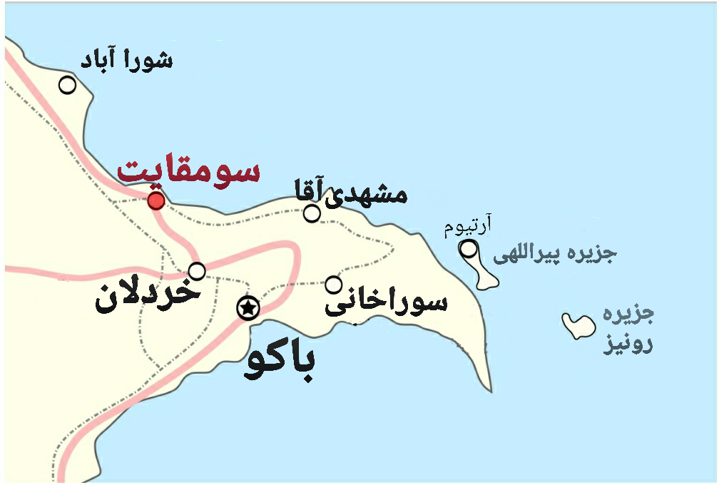
- The peninsula contains five districts: two urban (Baku and Sumqayit) and three considered suburban (Absheron Rayon, Pirallahi Rayon, and Khazar Rayon).
- During the late 19th century, exploitation of petroleum resources caused large-scale migrations of Iranian laborers to the Caucasus, especially Baku.
- Local scientists consider the area the ecologically most devastated in the world.
Defining the Landform
The Absheron Peninsula, like all peninsulas, is fundamentally a stretch of terrain that has water on the majority of its perimeter while maintaining a physical terrestrial link to the mainland. The very word carries a Latin etymology that captures this duality: paene, meaning 'almost,' combined with insula, meaning 'island.' In essence, a peninsula is an almost-island — land that has come tantalizingly close to being fully encircled by water but retains that crucial connection to the continent. This defining characteristic places the Absheron within a universal category of coastal geography rather than a unique anomaly. The waters framing such a landform are typically understood to constitute a continuous body, though they need not carry a single unified name for the peninsular classification to hold. What matters is the spatial relationship: water on most of the boundary, with a narrow or broad isthmus anchoring the land to the larger continental mass. This is the essential geometry that makes the Absheron a peninsula in the strictest geographical sense.
Taxonomy of Coastal Projections
Geographers do not reserve a single term for every stretch of land that juts into the sea. A peninsula may equally be described as a headland, a cape, an island promontory, a bill, a point, or a spit, depending on its shape, scale, and degree of prominence. Within this spectrum, a point is specifically recognized as a narrowing landform that extends into water, distinguished from a cape by its lesser visual and physical prominence. The Absheron Peninsula, as a substantial landform, would occupy a different tier in this hierarchy than a small tapering point or a narrow spit. The classification is not merely academic; it reflects how the landform interacts with the surrounding water and how it is perceived in terms of dominance along the coastline. Whether one calls such a feature a promontory or a cape, the underlying principle remains the same: it is a portion of the continental landmass that extends beyond the general shoreline into the adjacent water body, creating a distinct edge where land and sea meet in a concentrated, projecting form.
Regional Context in West Asia
In the broader landscape of West Asia, peninsular landforms vary enormously in scale. The Arabian Peninsula stands out as the sole and largest peninsular feature in that regional grouping, dominating the geography of the entire area. The Absheron Peninsula, by contrast, represents a much smaller expression of the same fundamental landform principle, nestled within a more complex mosaic of coastal and inland geography. Meanwhile, just to the north, Europe itself is sometimes regarded as one vast peninsula extending off the Eurasian landmass, making it one of the largest peninsulas on Earth and the only one to hold the formal status of a full continent — a designation that is largely conventional rather than strictly scientific. This continental-scale example underscores how the peninsular concept operates across every magnitude, from a small coastal projection to an entire landmass. The Absheron sits within this continuum of peninsular geography, a modest but geologically significant piece of land defined by its relationship to the waters that surround it.
The Water-Land Interface
The identity of any peninsula is inseparable from the water that frames it. For the Absheron Peninsula, as for all peninsular landforms, the surrounding water is generally understood to be a continuous body, even if different stretches of that water carry different names or belong to different hydrological systems. This continuity is what distinguishes a true peninsula from a mere bay or inlet. Interestingly, the peninsular concept can extend even to fluvial geography: a river that threads through an extremely tight meander may be said to form a peninsula within the nearly closed loop of water created by its own bend. This principle highlights that the defining feature is not the size of the water body but the spatial configuration — land enclosed on most sides by water while retaining a connection to the larger landmass. The Absheron Peninsula exemplifies this principle at a coastal scale, where the interplay between the projecting land and the encompassing water creates a distinct and recognizable geographical entity.
Gallery
Frequently Asked Questions
Who is Absheron Peninsula?
It is a 60-km tongue of land jutting eastward into the Caspian Sea from Azerbaijan's western coast, home to Baku and the metro satellites Sumqayit and Khyrdalan. In the popular eagle-shape comparison of Azerbaijan's outline, it serves as the bird's beak.
What are Absheron Peninsula's powers/role?
It functions as Azerbaijan's demographic and economic anchor, packing the country's most populous city and its surrounding urban area into a strip of temperate semi-arid land. It also carries the legacy of the region's earliest oil extraction.
How does Absheron Peninsula's story end?
Its narrative reaches its farthest point at Shah Dili (Shah Spit), the easternmost tip, which is now sheltered within Absheron National Park. That park marks where the peninsula's 60-km reach into the Caspian finally stops.
Why is Absheron Peninsula important?
It houses Baku, Azerbaijan's capital and largest city, making it the nation's population and economic center. Its strategic position on the western Caspian coast and its role in early oil production give it outsized historical weight for the country.
How big is Absheron Peninsula and what's the climate like?
The strip measures roughly 60 km (37 mi) in length and up to 30 km (19 mi) at its widest point. It sits under a Köppen BSk temperate semi-arid regime, receiving around or under 200 mm (8 in) of precipitation annually.
More in Peninsulas And Capes 1-24
Related in Peninsulas And Capes
Links follow this subject's own source article.
Elsewhere in the Peninsulas And Capes universe
Spotted an error? Know more?
This is a living reference — every entry is fact-audited, and reader corrections feed straight into our audit queue. Suggest an edit · See this site's audit record